By Grant Keddie. April 28, 2020.
Introduction
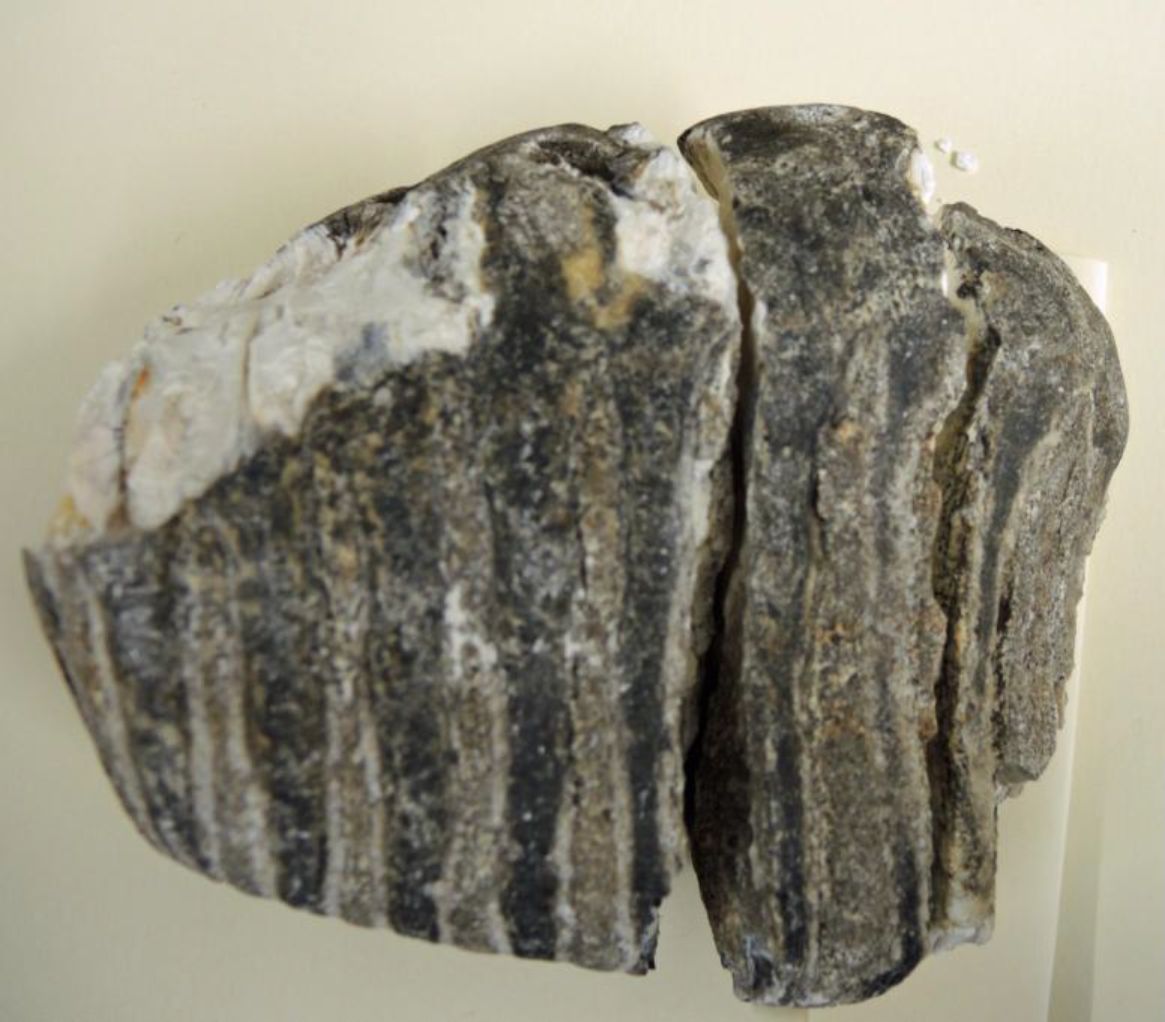
Twenty one thousand years ago a glacier that advanced from the north into Saanich Inlet melted away into a large fresh water lake. The lake burst through to the south sending millions of tons of sands and gravels across the landscape creating what is known as the Colwood Delta. Buried in the upper portions of this delta were the remains of a 20,000 year old mammoth.
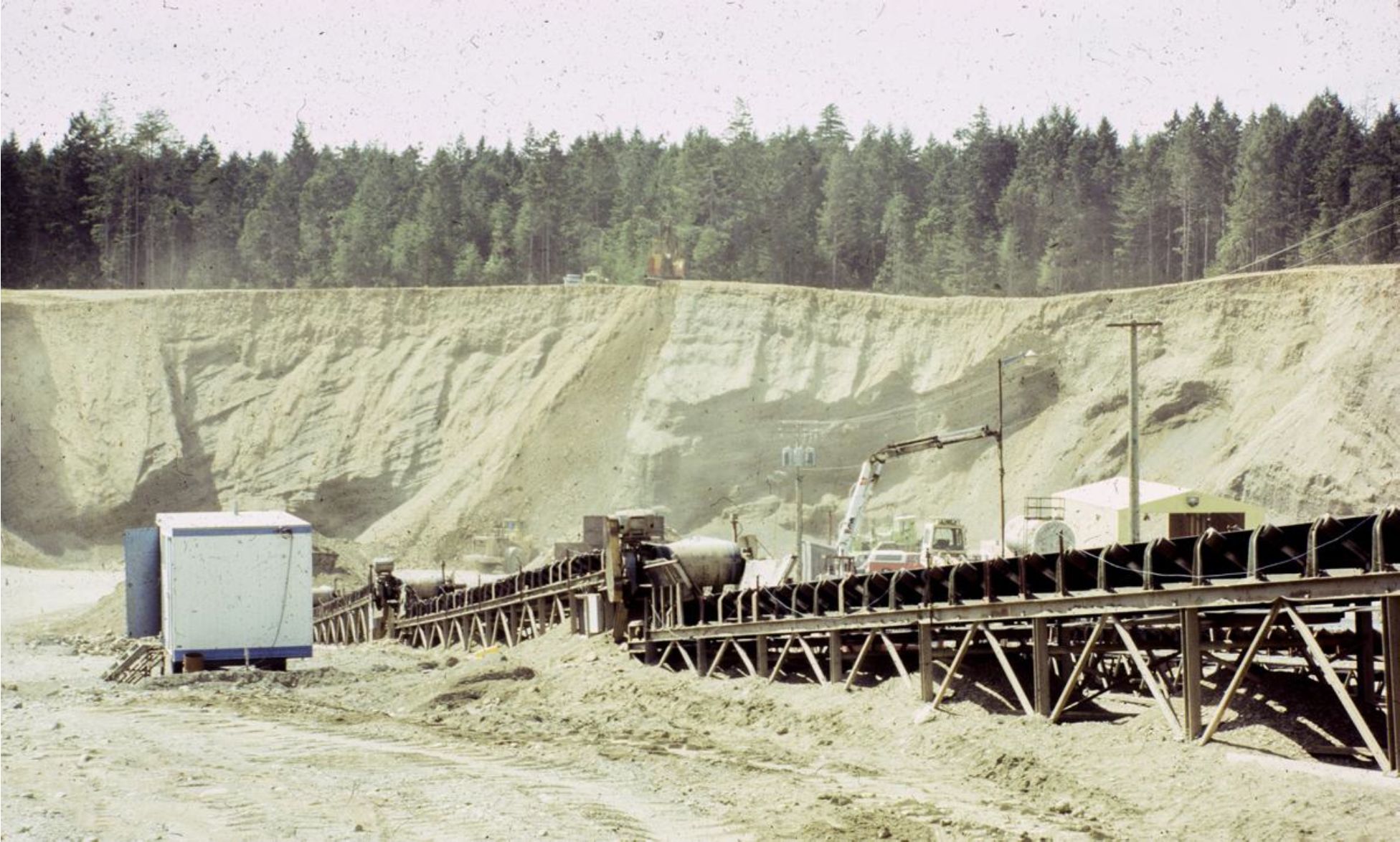
Over the last 100 years these sands and gravels have been largely removed and used to create the buildings and roads of the region. The community of Royal Bay has now immerged from the base of this ancient Delta.

The Human History
The landscape in the Royal Roads area was part of the treaty settlement with the Teechamitsa family of the Lekwungen indigenous people in 1850. There are no archaeological sites along most of the back of Royal Bay as the steep mostly eroding cliffs were not suitable for shoreline occupation. However, there is a heavy concentration of the remains of old village sites around Esquimalt Lagoon at the east end and a few small sites near Albert Head at the western end of the Bay.
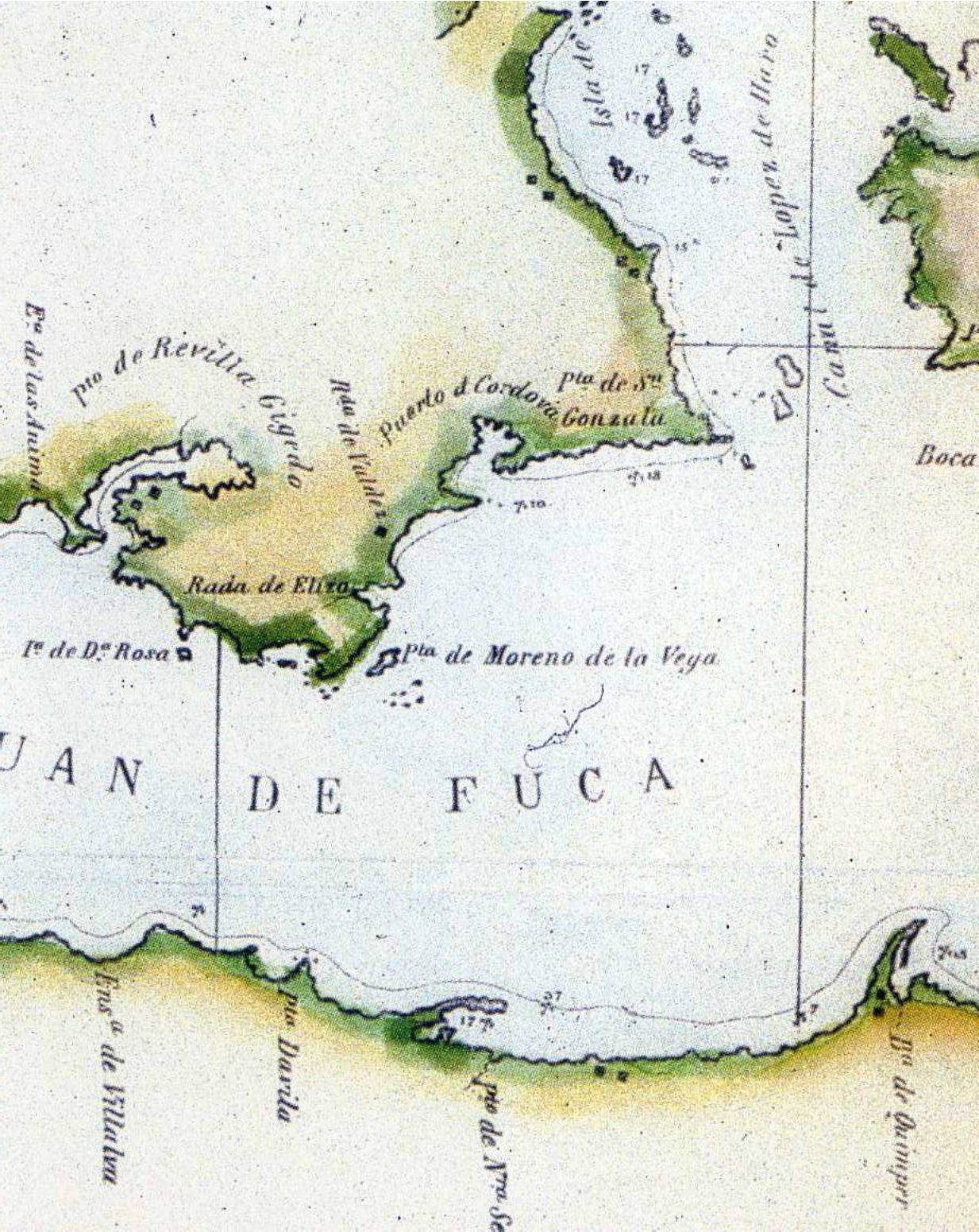
In 1790 Sub-Lieutenant Manuel Quimper of the Spanish Navy was the first European to venture inside the Strait of Juan de Fuca as far as Royal Bay. He used the name “Rada de Valdes y Bazan” for Parry Bay to the west but included the larger area east of Albert Head, which included Royal Bay and Esquimalt Harbour, as Pueto de Cordova.
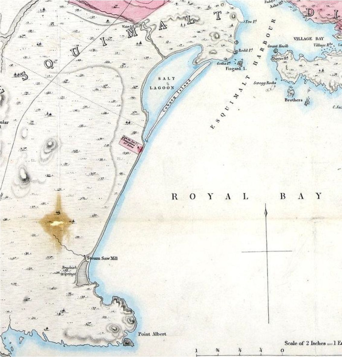
The name “Royal Bay” was used on the maps of 1846 produced by Captain Kellett during the first detailed survey of the area in the HM Herald. The name was given in association with the city of Victoria and Albert Head which flank the bay. This was also in conjunction with the naming of the peninsula to the east for HRH Queen Victoria’s consort, HRH Prince Albert of Saxe-Coburg & Gotha, who were married in 1840. When first named this peninsula was an island before it was filled in across the east end. The first properties allocated by the Hudson’s bay company, and mapped in this area in 1846, were lot VII at the East end of the Sax-Coburn spit and further to the East of Royal Bay at Albert Head Lagoon where a steam saw mill was established.
The name continued to be used on maps produced in 1854-55, along with the local use of the name Royal Roads the latter of which resulted in the name being used for the Military College, now Road Roads University.
Producers Rock and Gravel Company was started in 1909 and was once one of Colwoods largest industrial sites and major employers, extracting sand and gravel to meet local needs and also sending countless barge-loads to the Mainland and Washington State. It was one of the region’s largest industrial sites, and Colwood’s major employer. At its peak, it produced and barged out more than 20,000 tonnes of aggregate every day. It was decommissioned in 2007 because the 100 year lease was up and renewal was too expensive. The name was changed in later times to Royal Bay/Producers Pit.