
2012.
By Grant Keddie
James Teit, working with Clallum consultants in 1907-10, was told there was: “A village of them formerly in Victoria” and that “they were closely related to the Songhish” (Teit 1910).
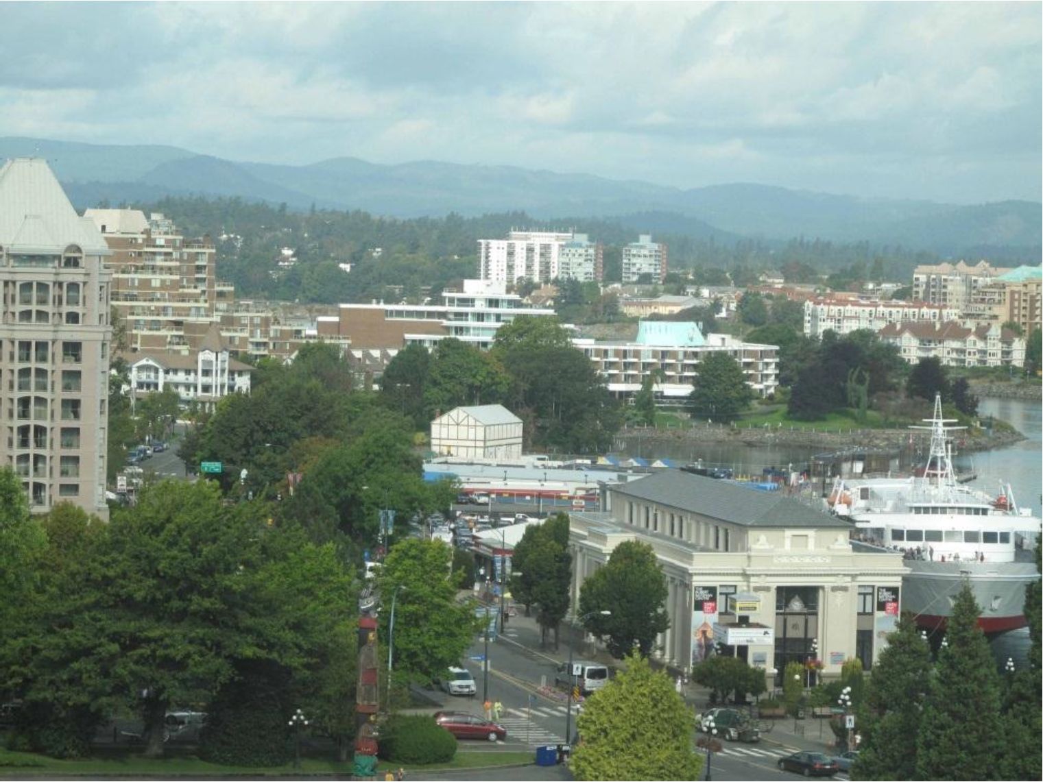
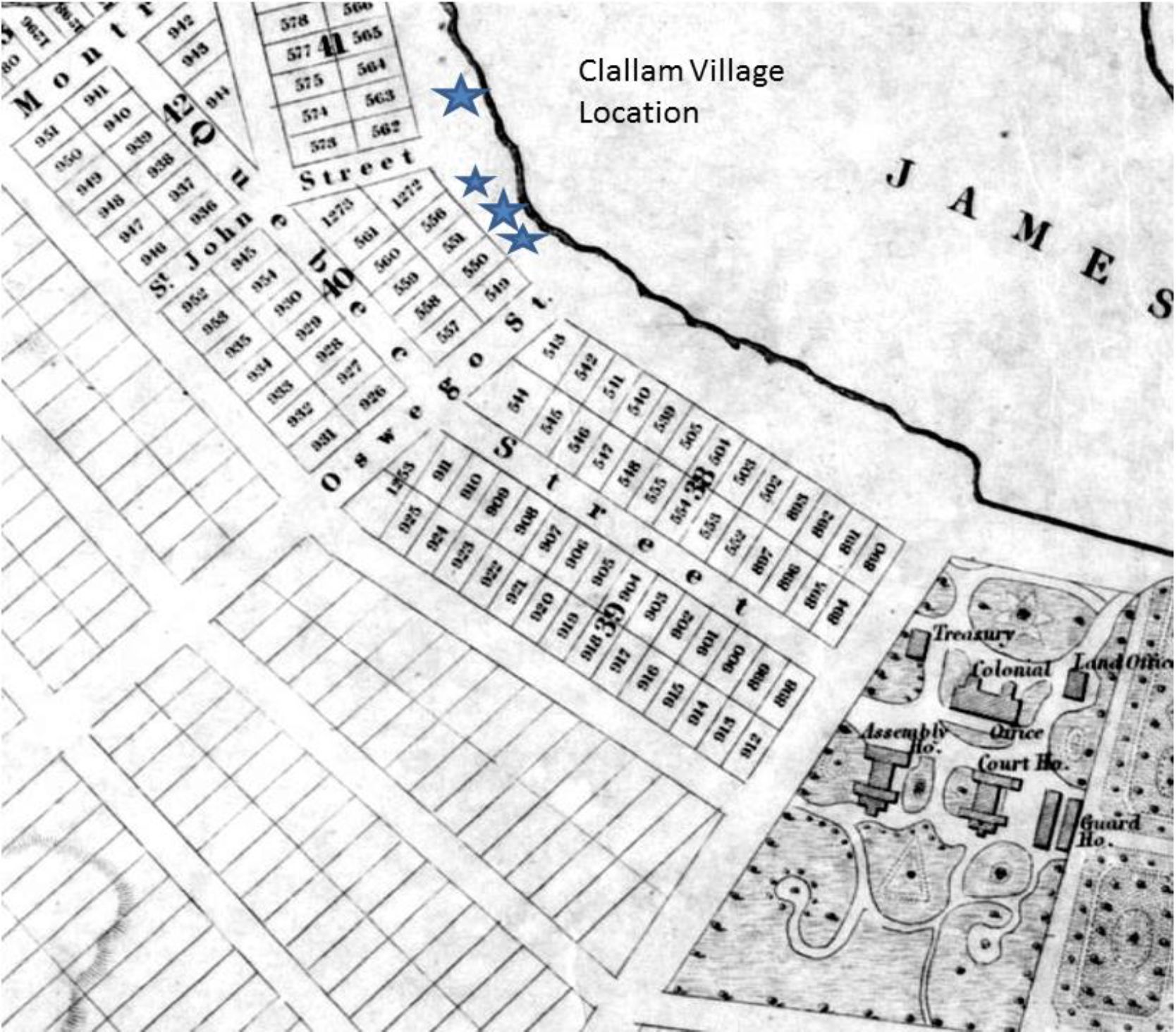
This location would be the “Clallam Village” referred to by the editor of the Weekly Victoria Gazette on August 28, 1858. It was located in the community of James Bay, west of the Legislative buildings and just to the east of Laurel Point. It can be estimated to have been occupied about 1847-1855.
This village contained Clallam people from the Olympic Peninsula, and some of the Sapsom or Kosampson people of the 1850, Douglas Treaties. The Clallam may have located here by right of intermarriage with the Kosampson – or, after the Clallam moved here from the Port Angeles area, the Kosampson joined them at the locality from a village in Esquimalt harbour. This was a short term historic village. There is no evidence of a village site being here before the late 1840s. For further information on the context of this article see Keddie (2003).
In 1905, Anthropologist Charles Hill-Tout collected information from Lekungun people who lived on or had close family ties to the Esquimalt Reserve. Hill-Tout’s interpretation of the information indicated that James Douglas had: “Also transplanted the village of the Qsapsem [Kosampson], who dwelt near the spot where the Parliament Buildings now stand”.
One of the people that Hill-Tout received his information from was “the wife of Tom James”. She was “Sitlamitza” or Mary Anne James. She was a part of at least one family of Kosampson people that lived in the “Clallam” village on the shore to the West of the Legislative buildings. Sitlamitza was born in this village about 1847 to 1850. But, as she left when only one or two years old, she would not have any personal memory of this location. She would have had the place of her birth explained to her by others, years later.
In 1912, William Roberts, a Songhees Band councilor, stated that Mary Anne James “belongs to Saanich Arm [Upper Gorge] and is of the Sapsam [Kosampson] tribe, which is not Songhees” [ie. Not a member of those people that made up the Songhees Reserve]. A response came from Reverend C. M. Tate, who worked among the Lekungen since 1873, and was an advocate for the James family who went to his church:
“The home of the Sapsams was Victoria harbor, and their village stood in front of where the parliament buildings now stand. The home of the Songhees was at Albert Head, from which place they moved to Victoria harbor when the Hudson’s Bay Company built their fort”.
A notarized statement, dated January 10, 1912, by Mary Anne James states in part: “That my Indian name is Sitlamitza. That I was born in my father’s house in front of where the present parliament buildings now stand. That my mother died in giving birth to me, and my father was killed when I was a baby. That my uncle, Chief Seesinak [“Say-sinaka” was the 5th person on the Kosampson treaty list of 1850 – his grandson was Joe Sinopen, born 1863, and his son Edward Joe, born 1885, were both former “chiefs” of the Esquimalt band], adopted me. That when Sir James Douglas moved the Indians to the reserve across the bay, my uncle asked for a place at Esquimalt. That my younger days were spent between Victoria, with my aunt, Seesinak’s sister, and Esquimalt”
It is likely that Mary Anne James’s mother’s family, father’s family, or both, originally came from Esquimalt harbour to join the Clallam village after the founding of Fort Victoria. This may have been a result of previous marriage relations with the Clallam – Mary Ann’s nephew Chief Edward Joe of the Esquimalt Reserve had a grandfather named Skekanim who was from Port Angeles. Later when treaty negotiations began in 1850, Mary Anne’s uncle “Say-sinaka” asked for a reserve in one of their old village sites back in Esquimalt harbour. It is likely that the family had maintained a seasonal occupation of the upper Esquimalt harbour area during their stay at the “Klallam” village or stayed with relatives who continued to stay there. There is no archaeological evidence of a pre-contact village site at or near the legislative Buildings.
Hill-Tout himself says that before the Fort was build the Kosampson lived “on the Gorge”. James Deans, who came to the Craigflower area in 1852, was told that their village was on the Gorge at what is now Kosampson Park.
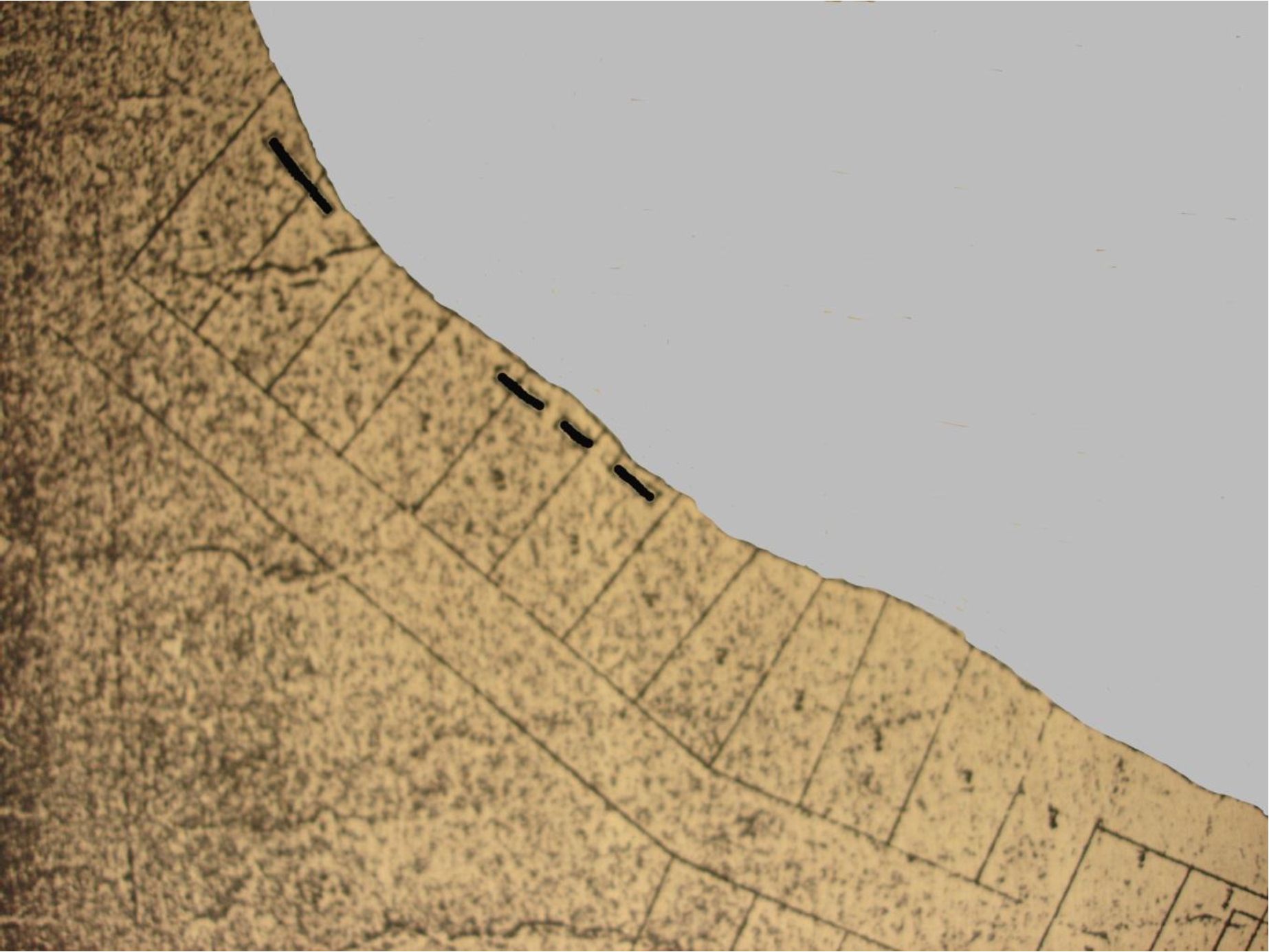
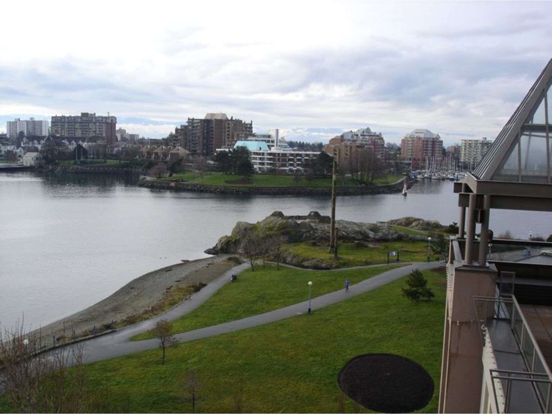
Outlines of the location of four houses at the site of the Clallam village can be seen in Figure 3. The map shows new surveyed lots several blocks west of the 10 acre “Indian Reserve” land that was to become the site of the Legislative buildings. The map shows four elongated houses with lot boundaries cutting through two of them – suggesting they were abandoned by this time. Three houses span Lots 513-15, and one house spans lots 516-17. This location today is along the waterfront in the area of Oswego and Pendray Streets at the S.E. corner of Laurel Point.
The Clallam village was located “near” the Legislative buildings as stated by Charles Hill-Tout. It appears that for political impact, Reverend Tate changed the story to “in front of” the Legislative buildings and his hand likely included this in the letter of Sitlamitza.
References
Hill-Tout, Charles. 1907. Report on the ethnology of the southeastern tribes of Vancouver Island, British Columbia. Journal of the Anthropological Institute of Great Britain and Ireland. 37:306-374.
Keddie, Grant. 2003. Songhees Pictorial. A History of the Songhees People as seen by Outsiders, 1790-1912. Royal B.C. Museum, Victoria.
Teit, James A. 1910. Salish Tribal Names and Distribution. June 10, 1910. Unpublished Manuscript in the Files of Franz Boas. American Philisophical Library. (Film 372, Roll 15) [RBCM Archives Additional Manuscript 1425, Reel A 246].