In Greater Victoria, inland Indigenous resource sites have been recorded in the past as a result of people finding artifacts while digging in their yards or construction projects turning them up accidently. They general do not have the easier to distinguish features of fire altered rocks and shell layers that are common in ocean shoreline sites. Archaeological testing was generally not done in the past where there was no previous record of a site being at a specific location.
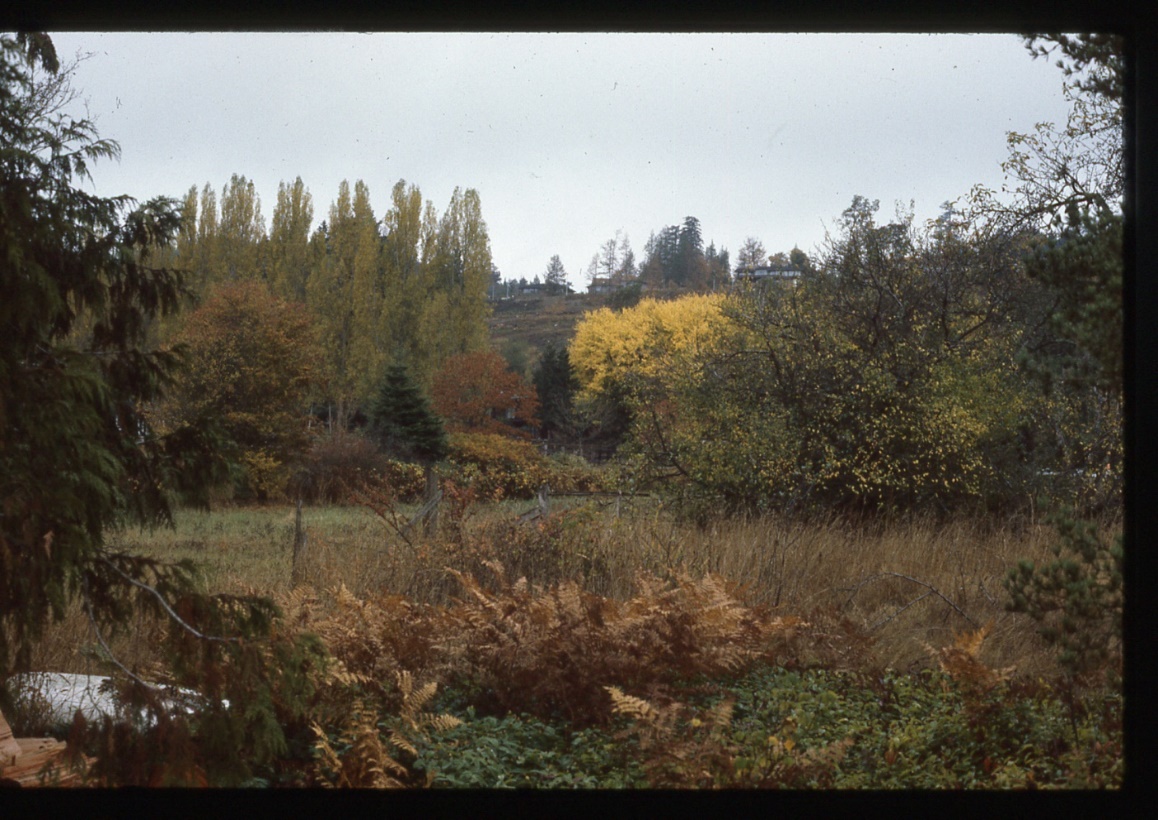
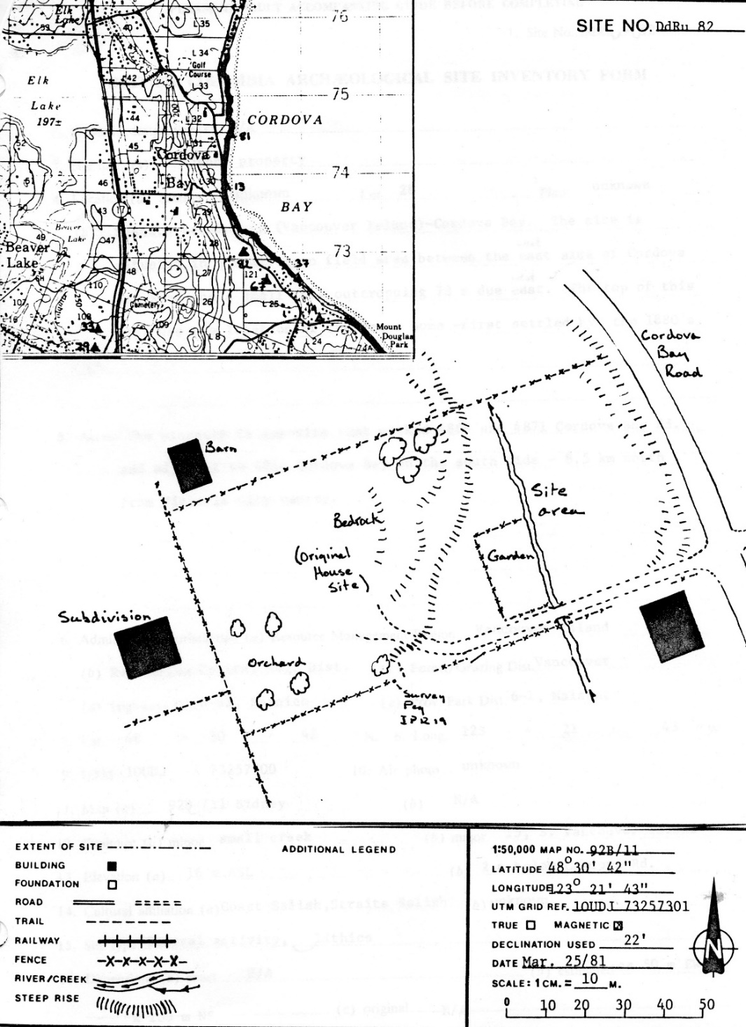
Many individual artifacts have been found along creeks and around swamps in greater Victoria. This archaeological site, DdRu-82, is an uncommon exception in having a large number of artifacts found in a relatively small area. This Indigenous resource location was on Galey Creek that ran through the old Galey Farm to Cordova Bay – it is now mostly in culverts. The Creek drained the low areas on the west side of Cordova Bay Road from Royal Oak Drive and crossed down into Cordova Bay just north of the rock bluff area that the locals called Kingfisher Point.
The Location History
The property was owned by the Jeune family for over 100 years. Edith Jeune collected 33 stone artifacts, mostly in her back garden (Figure 1 & 4), over many years. The collection area was opposite 4869 and 4871 Cordova Bay Road and next to 4864 Cordova Bay Road on the south side. This site was recorded by Archaeologist Steve Acheson on March 25, 1981. The location was shovel tested then, but no evidence of other buried cultural material was found.
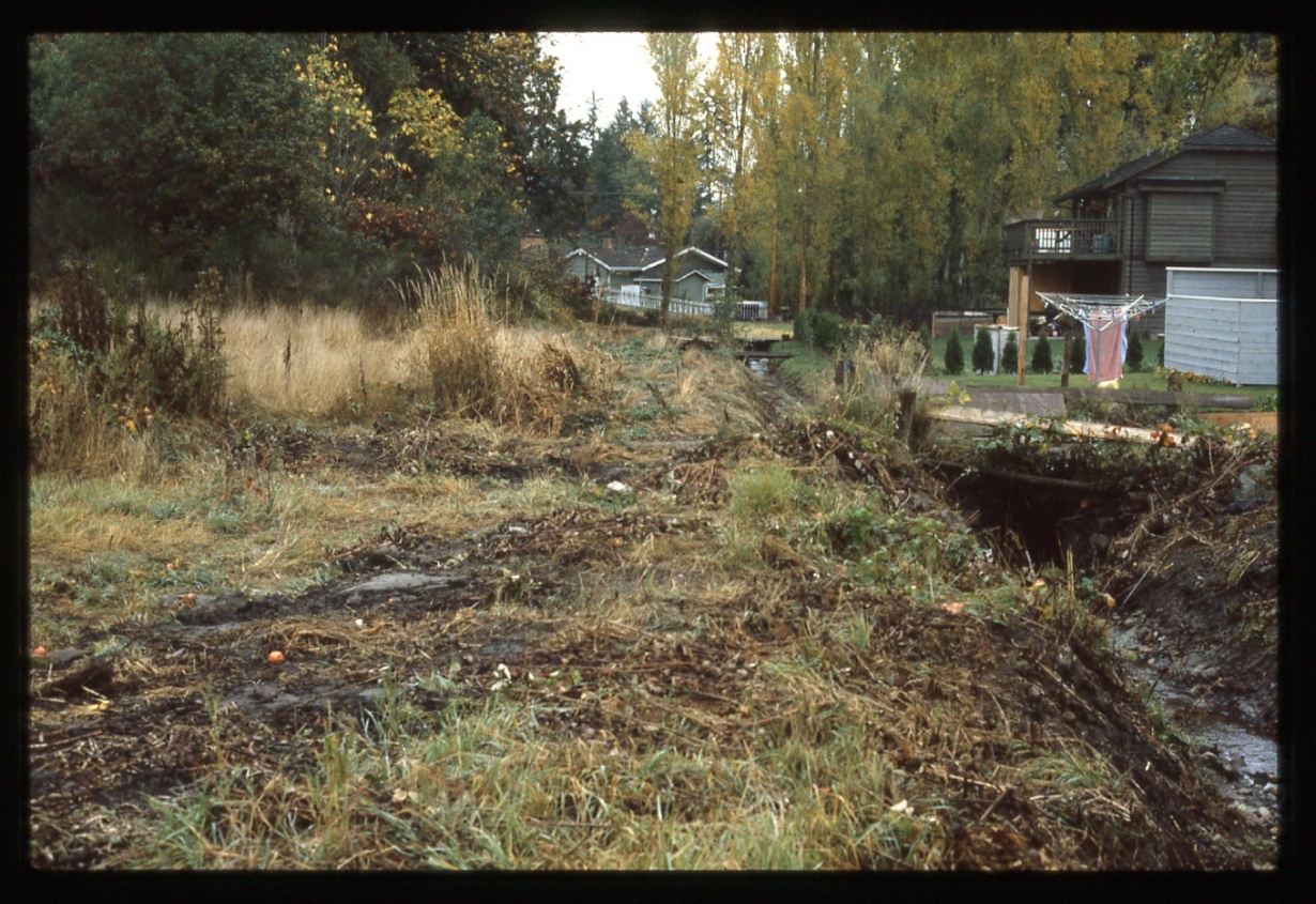
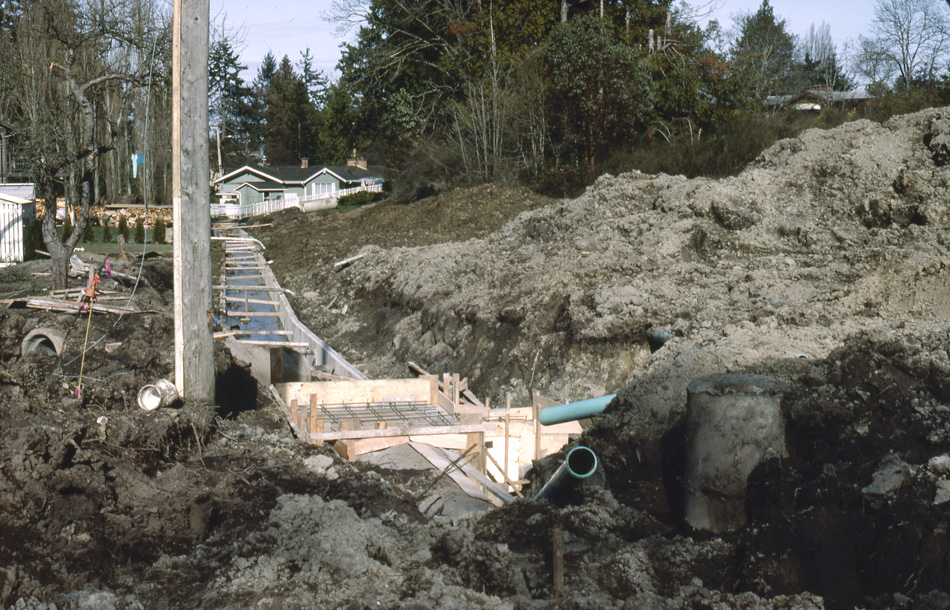
I visited, observed and photographed the location of February 14, 1984 (Figure 1) and again on February 14, 1986 when I was passing by and observed construction work being undertaken (Figure 2 & 3). I found a single spear point on the property that would have been part of Jeunes’ garden.
The Artifacts
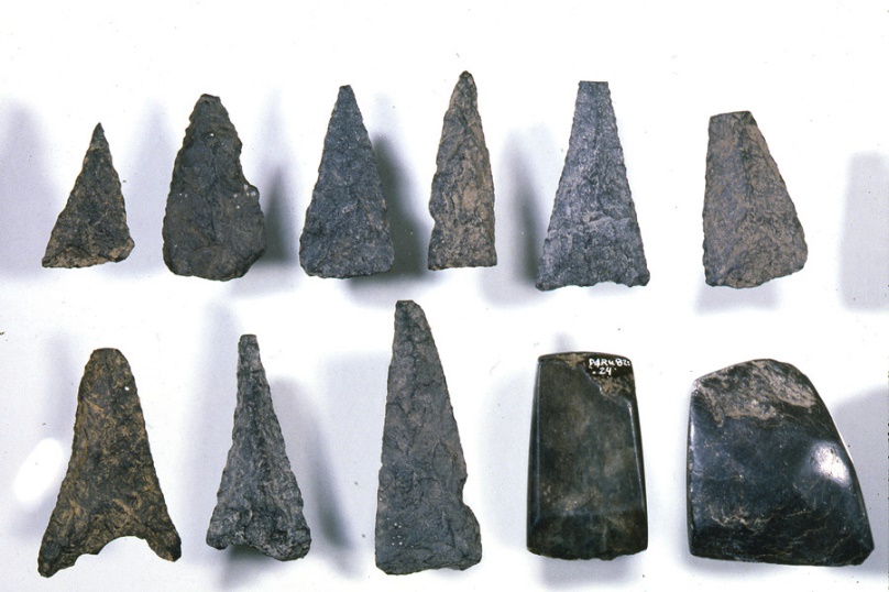
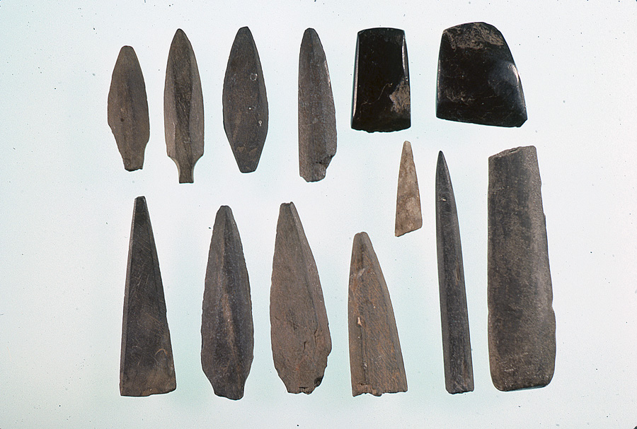
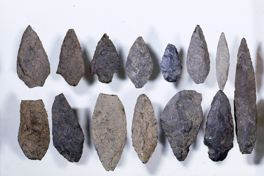
On April 9, 2008 the late Edith Jeune’s sister Alma Malcolm brought the artifact collection briefly to the R.B.C.M where I photographed it (Figure 4-6). Twenty- three of the artifacts can be classed as bifaces and projectile points (the three with stems) made of various grades of basalt, dacite and chert. Most of these are likely spear points, although a few could function as knifes. Nine are of a small, roughly triangular, shape. These are too thick to be hafted to arrow shafts and may also have been tips of spears. Eleven of the artifacts are ground slate points, six of which have broken bases. These are most likely spear points used in the same way as the others made of different materials. Different spear point types used in the same time period may be a result of some spears being throwing spears and others being thrusting spears. The latter would be used for killing animals trapped in pits or nets or finishing off injured animals.
Two of the artifacts are nephrite adze blades for chopping wood. A hand-maul reported on the 1981 site form was used mostly in wood working for pounding wedges (not present to photograph) .
A Hunting Site in the Forest
We know from historic observations, pollen studies, and the suitability of the soil and other ground deposits in this location, that it would have been a dense forest for at least the last 3000 years. The finding of spear points indicates it was a hunting site, most likely for deer and elk. The finding of adze blades and a portion of a hand-maul suggest some wood working activity, such as gathering bark or chopping trees of various sizes for potentially making anything from spear shafts to house posts. It could also be a place for gathering food plants that grew close to the stream.
The artifacts may represent sporadic activities that occurred over many years. There are no radio-carbon dates on this site. We know, however, that the style of artifacts found at the site could represent a long time period based on the dating of similar point styles from other sites in the region. The triangular shaped igneous rock points and the adze blades are more common in some sites dating between 1200 and 2500 years ago. Other igneous stone artifacts are of styles most common before 1800 years ago and extending back over several thousand years ago. The ground slate points are more common in the former period.