June 20, 2017. By Grant Keddie.
Introduction
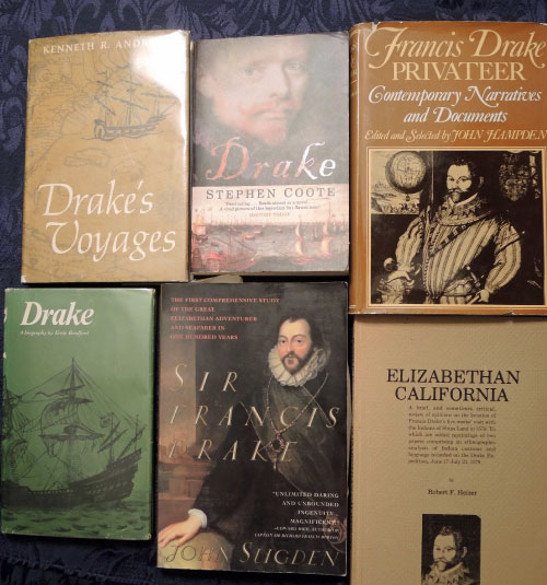
Figure 1. Examples of the hundreds of books written about Sir Francis Drake.
The Purpose of this article is to provide a background for those individuals who wish to understand more about the controversy regarding the voyage of Francis Drake to the Northwest Coast of North America. Where Drake landed on the Northwest Coast has been a subject of debate for over 170 years when it played a major role in the boundary settlement between Canada and the United States.
Proper study of this topic would require the combined research of many experts in Spanish and English literary history, maritime history, First Nations cultures and language and the history of geography and map making on the eastern Pacific coast.
I intend here, in Part 1, to provide my perspective on only some of the early literary sources on the subject and commentary of some of those scholars in the past that have examined this question. This is a subject with questions still remaining to be answered. I leave it to the reader to use this information, and to seek out the sources I have referenced, in reading and judging for themselves the many more accessible publications on this subject that have been written in recent decades.
Part II, in this series, will deal with the question of First Nations (Native Americans) and the Drake expedition. Part III, will look at the question of potential physical evidence from the Drake expedition to the Northwest Coast.
These notes in Part I, include a selected list of references that pertain to the discussions of the more northerly route of the voyage of Francis Drake to the Northwest Coast of North America in 1579. Brief descriptions are included to define the nature of the source material.
There are many hundreds of books and articles published on Francis Drake but few of them deal in any detail with the northern most part of his voyage on the Pacific coast of North America. Of those that do the sources they use are few. I will refer to some of the less known early sources of information on Drakes voyage and then the two early sources that are most commonly referred to.
I suspect that as Spanish scholars dig deeper into the Archives new information will arise to provide a more comprehensive view of this subject. New archaeological evidence is almost certain to turn up. The landing place where the crew stayed would be strewn with items such as broken ceramics. And if not, found in nearby archaeological sites where it was taken away or given to local First Nations. Other items should be expected to be traded further away by local First Nations. One of the best candidates for such an assemblage is the earliest historic material found buried under a mud slide at the Ozette site on the Olympic peninsula of Washington State.
Early Spanish Documents
Depositions of Nuno da Silva 1579-80, and others. Archivo General de Indias, Seville, File 2-5-2-2/2.
This Spanish document includes the deposition of San Juan de Anton, written by Pedro Samiento de Gamboa. In Vol. XCIV of the Coleccion de Documentos Indeditos para la Historia de Espana, Madrid, 1889. These have been translated into English and published by Nuttall (1914).
Depositions of John Drake of March 24, 1584 in Santa Fe and declaration before a Spanish Inquisitor January 8-10, 1587, in Lima Peru. Archivo General de Indias, Seville, Legajo of papers related to Drake, File 2-5-2/21.
Both are printed with translations as Appendices I and II in Eliott-Drake (1911). Parts are also translated by Nuttall (1914).
Francis Drake’s nephew John Drake was captured by the Spanish. Records of his statements still survive. The Spanish depositions mention four times that Drake went to 48 degrees north. Drake “would sail north as far as he could in search of the strait which the cosmographers have been insistent exists, and having found it would return that way to England”. On his journey Drake “saw five or six islands of good land. …largest and the best, Nueva Albion. Here he remained a month and a half, repairing the two ships which he had with him” (Antonio de Herrera reprinted in Wagner 1926:330-334).
In his second deposition John Drake stated that at Nova Albion Francis Drake “landed and built huts and remained a month and a half, caulking his vessel. …Here he caulked his large ship and left the ship he had taken in Nicaragua” (Nuttall 1914). The significant information here is the statement that Drake repaired his ship on an Island.
Diary of Richard Madox. 1582. British Museum. Document 38. Private.
This document is reproduced & discussed in Donno (1974) and Taylor (1957).
Richard Madox met with and corresponded with Sir Francis Drake while assisting in the preparations for the Fenton expedition of 1582. Madox was the minister on board Edward Fenton’s ship with five members of Drake’s expedition: Captain John Drake (the nephew of Sir Francis Drake), Lieutenant William Hawkins, pilots Thomas Hood and Thomas Black Collar and the musician Simon Wood. Madox regularly dined with Hawkins and Captain John Drake.
Madox mentions on April 30, 1582 that “after supper Captayne Drake made a discourse on his voyage and also his extemytyes on his voyage” (Donno 1974:309). On October 13, Madox mentions: “In Ships Land which is the back Syde of Labradore and as M. Haul [Christopher Hall] Supposeth nye thereunto Sir Frances Drake graved and bremd his ship the[r] at 48 degrees to the north”. (Donno 1974:208-209).
The Naval Tracts of Sir William Monson [composed mainly around 1640, but including many professional papers and official memoranda on naval affairs originating during the preceding half-century; largely printed in Awnsham and John Churchill’s Collection of Voyages and Travels (1704-1732), Vol. III, pp. 163-560; but complete, from the original MSS., here for the first time], edited by M. Oppenheim (5 vols., Navy Records Society nos. 22, 23, 43, 45 and 47, London, 1902-14). [Extracts from Monson 1704].
Monson was a distinguished Naval officer who wrote manuscripts on Naval history. Some of his information is from then published sources, but it is uncertain what he meant when he said “with some Addition of Sir Francis Drake”. In his introduction he states that Drake “ventur’d upon and unknown Sea in 48 Degrees, which Sea or Passage we know had been often attempted by our seas, but never discover’d”. Later: “From the 16th of April till the 5th of June, he sail’d without seeing Land, and arriv’d in 48 Degrees, thinking to find a Passage into our seas, which Land he nam’d Albion; the People were courteous, and took his Men for Gods; they live in great extremity of Cold and Want; Here they trim’d their Ship, and departed the 25th of July, 1579” (reprinted in Wagner 1926:325-26).
The Documents Most Commonly Referenced
The Famous Voyage of Sir Francis Drake into the South sea, and there hence about the whole Globe of the earth in the yeere of our Lord, 1577.
This manuscript was published in 1589. The original in the British Museum was inserted in a copy of Richard Hakluyt’s 1589, The Principal Navigations, Voyages and Discoveries of the English Nation, London. But this document may not have been printed until 1594 or 1595.
The writings were compiled by Richard Hakluyt from three sources – John Cooke’s manuscript; part of the Anonymous Narrative, and part of the manuscript of Francis Fletcher, the chaplain on Drakes ship. The manuscript is not as comprehensive as the later 1628 World Encompassed, which used more of Fletcher’s manuscript, and included more details about the voyage north of 42 degrees.
Condensed versions of this were published in Latin (Theodore de Bry 1599) and German (Levinus Hulsius 1603) and a more complete version in French (Paris 1613). English reprints can be found in Irvine (1927) and Wagner (1926).

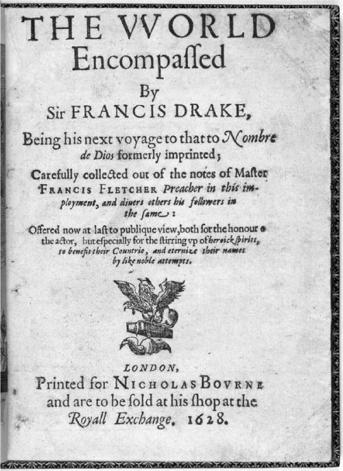
The World Encompassed. Being his next voyage to that Nombre de Dios formerly imprinted, Carefully collected out of the notes of Master Frances Fletcher preacher in this imployment ….By Francis Drake. 1628. Printed by Nicholas Bovrne. [Reprinted in Temple (1926)].
This document was produced by Drake’s Nephew, with the same name. Sources are Francis Fletcher’s manuscript, the Edward Cliffe account (Cliffe was only on the first part of journey), and relations of Nuno de Silva and Lopez de Vaz.
It is noted in this manuscript that: On June 5, they were forced “to cast anchor in a bad bay …From the height of 48 deg., in which we were”.
Francis Fletcher’s Narrative. British Museum. Sloane Ms. No. 61. (1588 – 1596).
Francis Fletcher wrote this large manuscript after his voyage on Drake’s ship. The original manuscript is missing, but not before it was used as a reference by several authors. The British Museum manuscript is a partial copy made by John Conyers.
The Anonymous Narrative. British Museum, Harleian Mss, No. 280, Folio 23. A copy is Appendix No. III, in the 1854 edition of the World Encompassed. [It is printed in Wagner (1926)].
This manuscript covers the second part of the voyage. It was written after the voyage from information from unknown members of Drake’s crew. The Narrative says Drake sailed north to 48 degrees “still finding a very lardge sea trending toward the north but being afraid to spend long time in seeking for the straite hee turned back againe still keeping along the cost as nere land as hee might, until hee came to .44. gr. And then hee found a harborow for his ship where he grounded his ship to trim her, & heere came downe unto them many of ye contrey people” (Wagner, 1926:277).
The marine surveyor George Davidson (1908) favours the Famous Voyage, attributed to Francis Fletcher, due to its currency of time – 1589. He suggests that the editor Richard Hakluyt, had an interest in the subject and being a contemporary of Drake would have received more accurate information as he was “within earshot of Drake, Fletcher and others”. He suggested that the World Encompassed would be bias because it was produced by Drake’s Nephew and published much later [1628; 1635; 1652]. He suggested that his nephew would “gather what he could in favor of his uncle although he had been dead thirty six years” (Davidson 1908:87). “When the subject is viewed in different aspects it is a reasonable assumption to say that Hakluyt was the author of the “Famous Voyage” and that he had access to good and tangible authority; and could weight the evidence presented by different narrators”. Davidson believed that the World Encompassed “appears to have been based upon, the “Famous Voyage”, and from traditions, or records of some people who accompanied Drake” (Davidson 1908:88).
JOHN STOW
John Stow, in 1592, said Drake sailed to 47 degrees north and turned back to 38 degrees. Stow wrote in his Chronicles in 1592, in an article titled Francis Drake His Voyage Round The World: “the 16. of March being on land at the Ile of Canoes, hee passed foorth northward till he came to the latitude of forty seaen, thinking to have come that way home: but being constrained by fogs and cold winds to forsake his purpose, came backeward to the lineward the tenth of June 1579.and stayed in the latitude of thirty eight to graue and trim his ship, until the fiue and twenty of July, and from thence setting his course Southwest he fell the third of October with an Ile 8. degrees from the line Northward, and the 4. of Nouember he fell with Trenate one of the Iles of Moluca” (Wagner 1926:304., from 1635 edition).
Wagner thinks this publication of Stow’s is the basis for the route shown on the Broadside Map published c. 1595 (Wagner 1926:140).
Did Drake believe in and attempt to find the Northwest Passage?
Background setting:
The first person to put forward the proposal that England should seek a direct polar route to China was the merchant adventurer Robert Thorne the Younger. He set out the plan in a letter of 1527 and c. 1531 with an address to King Henry VIII. It was again brought to Henry’s attention by a friend and associate of Thorne’s named Roger Barlow in a cosmography dedicated to Henry VIII in 1541. For 50 years before Drakes voyage of 1579 there were a number of strong supporters (scholars, writers and merchants) of northern exploration to find a northern route to Asia. A northern route was seen as an important outlet for woolen goods that were England’s main export. Expeditions were launched to reach China by both the Northeast and Northwest. England’s search for the Northwest Passage began with the voyages of Sebastian Cabot in 1508-09.Cabot sailed in ships of Robert and William Thorne (the father and uncle of Robert Thorne the younger). Cabot claimed to find the entrance to the Northwest Passage and this became publicly accepted. The earliest cartographic record of this strait between North America and Asia was in 1530 – later it became known as Fretum trium Fratum. The revival of plans for the discovery of the new passage in the 1560s owed much to the initiative of Humphrey Gilbert as promoter and publicist. In 1566 Gilbert wrote “A Discourse of discoverie for a new Passage to Cataia”. It was published in 1576 with a map showing the Northwest Passage. After Frobisher’s voyage of 1576 new hopes were aroused for further voyages (See Helen Willis 1984). The backers of Frobisher were also the backers of Drake (see Symons 1999).
An important document in the British Museum that reveals Francis Drakes beliefs is found in Bernardino de Mendoza’s
Document 2. Dispatches from Bernardino de Mendoza to Phillip II, December 1580 – April 1581. This document is reproduced in English and discussed in (Taylor 1957 and Donno 1974).
On December 20, 1580, Bernardino de Mendoza, the Spanish Ambassador whose spy network reported on the activities of Drake and other Englishmen, revealed the Indies Project in which in which Drake was a financial subscriber and who took an active role in the preparation of the voyage. Drake was to take 10 ships to the “Isles of Moluccas” via the Cape of Good Hope. The voyage was undertaken by Edward Fenton, with five men from Drake’s earlier Northwest Coast expedition(Taylor 1957:5).
Mendoza sent a dispatch to Philip II on January 9, 1581, stating that government officials were “pressing Frobisher to renew his attempt (in spite of late unsuccess) to discover a Passage to Cathay, which Drake is of opinion must exist there” (Taylor 1957:16:54). Frobisher and Drake knew each other and had many of the same backers (Symons 1999).
Drake did not go to the East Indies himself (he was knighted on April 6, 1581 and the Queen forbade him to leave the country), but instructions given by backers of the project when he was to be a participant are revealing. The preparatory notes of Arthur Atye [c.1581] were to instruct Drake “not to passe Chyna to the northeastwarde: so will the traffique be better made, and the reason of this charge to be given him is, least perhaps he showeth some desire to searche out his formerly pretended passage N. W. and so hinder this voyage wch [which] is only for trade” (Taylor 1957:16. Document 10).
The project was undertaken with Edward Fenton in charge, but Drake was a financial subscriber who took an active role in the preparation of the voyage. Two men from the Drake expedition, Thomas Blacollar and Thomas Hood went on the Fenton expedition as pilots.
The final instructions issued April 9, 1592 to the leader of the expedition Edward Fenton included:
“10 Item, you shall not passe to the Northeastward of the fortie degree of latitude, at the most, but shall take your right course to the Isles of Molucas, for the better discoverie of the Northwest passage, if without hindrance of your trade and within the same degree you can get any knowledge touching that passage, wherof you shal do well to bee inquisitive as occasion in this sort may serve” (Taylor 1957:54. Document 35. The Instructions, as Issued on 9 April 1582).
Taylor notes that an earlier draft of this item 10 read:
“You shall not pass to the north-eastward of the 40 degrees of latitude at the most, because we will that this voyage shall be only for trade and not for the discoverie of the passage by the northeast to Cataya, otherwise than if without hindrance to your trade and within the said degree you can get any knowledge.” (Taylor 1957:54, note 3).
These instructions suggest that there was fear that Drake may go off on his own looking for the Northwest passage. He was ordered to put a priority on undertaking his trade duties, and only if he had sufficient information to indicate that there was a Northwest passage should he pursue it.
The British sent Martin Frobisher to find the Northwest Passage in 1576. Frobisher and Drake knew each other and had many of the same backers (see Symons 1999).
To what latitude did Drake go on the West Coast of North America?
Richard Madox (who had met and corresponded with Sir Francis Drake while assisting in the preparations for the Fenton expedition of 1582) reports in his private diary of March 15, 1582 that he had discussions with Mr. Ashley a merchant who was preparing beads and other trade goods for a proposed trading voyage of Humphrey Gilbert. Ashley had heard of a report “Sayd of the Yndians that ther was a saylable passage over America between 43 and 46 degrees throe which he sayd Sir Frances Drak cam hom fro the Moluccas” (Donno 1974:96); (Taylor 1957:152. Document 38. Private Diary of Richard Madox – Taylor mistakenly identifies the date as April 30).
Richard Madox was the minister on board Edward Fenton’s ship sailing to South America on the Galleon Leicester in 1582 with five members of Drake’s expedition: Captain John Drake (the nephew of Sir Francis Drake), Lieutenant William Hawkins, pilots Thomas Hood and Thomas Black Collar and the musician Simon Wood. Madox regularly dined with Hawkins and Captain John Drake.
Madox mentions on April 30, 1582 that “after supper Captayne Drake made a discourse on his voyage and also his extemytyes on his voyage” (Donno 1974:309). On March 15, Madox notes that “during our conversations I learned that ravens were very often seen by Francis Drake in Labrador and Caliphurnia, but we have not seen any as yet” (Donno 1974:215). His reference here to Labrador seems to refer to the area north of California – for on October 13, 1582 Madox mentions: “In Ships Land which is the back Syde of Labradore and as M. Haul Supposeth nye thereunto Sir Frances Drake graved and bremd his ship the[r] at 48 degrees to the north. The people ar for statue, color, apparel, diet, and holo speach lyke to thos of Labradore and is thowght kyngles for they crowned Sir Frances Drake. Ther language is thus. Cheepe, bread. Huchee kecharoh, sit downe. Nochero mu, tuch me not. Hioghe, a king, Ther song when they worship God is thus: One dauncing first with his handes up and al the rest after lyke the priest and people, Hodeli oh heigh oh heigh ho hodali oh. Yt is thowght that they of Labradore worship the son and the moon but [whether they] do of Calphurnia I kno not.” (Donno 1974:208-209). (see slightly different version of Taylor – E.G.R. Taylor 1932).
The Hall referred to here is Christopher Hall. Donno speculates that the source of the native words is “probably William Hawkins” but suggests “John Drake is a possibility” (Donno 1974:209, note 2). (see slightly different version of Taylor (E.G.R. Taylor 1932).
John Drake (Wagner, 1926:138) said the ship repaired at a bay in 48 degrees. Wagner suggests this statement was a conspiracy to claim to 48 degrees for political reasons (p. 140). It would seem more likely to me that Drake would have claimed a location further south so the Spanish did not discovered the location they had found further north. In a second deposition John Drake stated that it was in 44 degrees – possibly 600 miles from the coast. One interpretation here is that the ship, after moving rapidly north to 44 degrees in a storm, was forced by Northwest winds to head Northeast to come near the shore at 48 degrees? This fits best with the statement below.
John Drake’s declaration before a Spanish Inquisitor at Lima in 1581. [Davidson 1908:17-18 from translated narrative in The Western Antiquary” Plymouth, November 1888, p. 83 – As quoted by R.M. Brereton]: “They then shaped their course by northwest and northeast and proceeded 1000 leagues as far as latitude 44 deg., always on the bowling. Afterwards they tacked about and went to California and discovered land in 48 deg., where they landed in order to take up their quarters, and remained there a month and a half repairing their ship and taking in her sea provisions which were Mareleones [seals] and wolves [sea lions]”. On epossible location for this is Race Rocks off Vancovuer Island near the entrance to the Strait of Juan de Fuca.
John Drake in his second deposition of 1582 [Zelia Nuttall 1914; Heizer, p. 281] stated:
“There he [Francis Drake] landed and built huts and remained a month and a half, caulking his vessel. The victuals they found were mussels and sea lions. …these people were peaceful… but gave them no food. …Here he caulked his large ship and left the ship he had taken in Nicaragua”.
The famous Arctic navigator John Davis, after whom Davis Strait is named, was on the 1591 expedition of Thomas Cavendish to the Strait of Magellan and made three voyages to the northwest in search of the Northwest Passage. He indicated in his 1595, publication Worldes Hydrographical Discription that after Drake entered into the south seas “he coasted all the Westerne shores of America vntill he came into the Septentrionall latitude of forty eight degrees being on the backe syde of Newfound land”. [Davidson 1908:17; Wagner 1926:315].
The historian, Wagner concludes from his examination of maps that what they have in common “is the placing of Drake’s port from which he departed to the southwest, south of a cape which is variously laid down at latitudes between 40 [degrees] and 42 ½ [degrees]. This cape is unnamed except on Molyneux’s globe as Cape Mendocino (Wagner 1926:142).
George Davidson calculated that the Golden Hind traveled 71 miles per day for 1160 leagues by June 5 – the general direction then at latitude 40 degrees N and longitude 129 degrees west, or about 70 leagues west of Cape Mendocino. Davidson said the N.E. trade winds are lost at about 30 degrees, but mentions one voyage in which they were not found until reaching 41 degrees N. We do not know where they may have been in 1579. Vessels coming from the Philippines encountered N.W. winds (September – October) between 35 and 40 degrees and usually about 10 degrees of longitude distant from the Coast.
Davidson (1908:88)chastises others for believing “that Drake sailed his dull ship six degrees of latitude in less than two days against a north-wester”, but we do not know for sure if he was sailing against the wind or with it – it would depend on where he was at various times.
Wagner indicates that in The Famous Voyage they traveled 600 leagues between April 16-June 3 and arrived at 42 degrees on June 5th. Hakluyt reprinted 1600 leagues and eliminated “in longitude”. The Anonymous Narrative has Drake sailing north 800 leagues. The World Encompassed stated “500 leagues in longitude to get a wind and between that and June 3, 1400 leagues in all, till we came into 42 degrees of north latitude”. Wagner thinks he could only make it in 50 if he went a long distance west. Wagner (p. 136) suggests Drake was at 42 degree or 44 degrees latitude when encountering N.W. winds and turning east. The Anonymous Narrative says he reached 48 degrees.
Wagner (p. 137-8)points out that the route shown on the Molyneux globe of 1592 extends north to 47 or 48 degrees and to the Moluccas begins at or just below Cape Mendocino at about 42 ½ degree. The Dutch and French Drake maps show a similar route “except that the point of departure to the southwest” about 40 ½ – 41 degrees. The Silver Medal and the Hondius Broadside maps depict the route as extending to 48 degrees with the point of departure S.W. at about 38 degrees. Wagner notes Hakluyt’s choice of the lower latitude in Fletchers narrative over the Anonymous Narrative versions and speculates that Hukluyt must have had: “Some positive knowledge of the correctness of the latitude, or a conclusion based upon the general probabilities of the case, that Drake could not have reached the coast as high a latitude as 46 degrees”.

George Davidson (1908:27) argues that it would be impossible to sail the Golden Hinde from latitude 42 degrees to 48 degrees against a strong head wind and a heavy sea swell. But was it against or tacking N.E. with the N.W. wind? And how far north were they before they headed N.E.? Davidson concluded that the Golden Hinde was at latitude 42-43 degrees and made landfall about 42 degrees. Drakes first anchorage was at Chetko Cove in latitude 42 degrees, 3 minutes, and his second anchorage was “under eastern promontory of Point Reyes Head, in latitude 38 degrees “where only the white cliffs faced his ship” (Davidson 1908:108).
The problem we have here is trying to choose which sources that give the northern latitudes of Drake’s furthest extend – and the place where he stayed to careen his ship -are the most reliable. In order to judge how far north he went in a particular time period, we need to judge where he was when he started his travels from south to north and the directions he took. We need to know weather and/or when he encountered N. E. and N. W. winds.
There are no solid facts here. The reasons we choose some over others at this point can only be based on a number of other facts, circumstances and subjective reasoning. If Drake went far W.N.W. out to sea and caught fast winds going north before encountering N.W. winds that forced him to head in a N.E direction he could have first come ashore around 48 degrees north. This is a scenario presented by Bishop (Figure 6) in which I am open to as a possibility.
Was Drakes intention to find a place to set up a British colony?
Two men, John Butler and John Oxenham, from the Francis Drake voyage were captured by the Spanish. On February 20, 1579, they were asked questions before Spanish Inquisitors in Lima Peru. When asked if the English were attempting to set up Colonies on the Pacific Coast Butler replied that Sir Richard Grenville had applied to set up at Rio de la Plata, but did not proceed. Butler said the “Francis Drake had often spoken to him saying that if the Queen would grant him a license he would pass through the Strait [Magellan] and found a colony on the west side in some good land” (Wagner 1926:5-6 – from Nutall 1914. Butler’s deposition, 5, Oxenham’s 8).
Henry Wagner was an excellent scholar of his day. At the time of his writing he did not have all of the information that is available today. His comments on this subject of Drake’s voyage were interpreted by his view that Drake was to establish trade in the Moluccas and not to look for a Northwest Passage. Wagner stated that trade in the Moluccas “might have been either the sole or chief object of his expedition”. Wagner did not believe that colonization was on the agenda and considered the Anonymous Narrative statement about the Strait to be “ambiguous”. He indicated that “All that can be conceded is that Drake, and certainly Fenton [reference to Edward Fenton’s voyage of 1582-83], had instructions to plant a factory somewhere, if a good opportunity offered” (Wagner 1926:15-21).
Wagner rejected the information from The World Encompassed as an extrapolation from The Famous Voyage and other sources (Wagner 1926:141).
What information was on the maps captured by Drake?
Davidson (1908:35) suggests that the maps “laid down to” latitude 43 degrees. Davis was of the belief that the 48 degrees latitude “can not be accepted” (1908:37). He expressed his “disbelief of the idea” of Drakes attempt to reach the “ice barred north coast” (1908:36).
Davidson notes that a 1585 letter of the Viceroy of New Spain to the King of Spain pertaining to the survey of the coast of California points out that the galleons returning from Manila “kept in sight of the land for seven hundred leagues before reaching Acapulco”. Davis speculates that: “It is barely possible the galleons may have been at Drake’s Bay before the San Augustin under Cermeno was wrecked in that vicinity in 1595, and where Vizcaino anchored the San Diego in January 1603” (1908:58). Davidson notes Cape Mendocino at 40 degrees, 26 minutes is that on Mercator 1569 and Ortelius 1570 maps (1908:101). “Cabrillo and Ferrelo made the landfall of the high wooded shoulder behind Fort Ross in latitude 38 (degrees) 31(minutes) El Cabo de Pinos: it is very probable he saw the crestline of the coast range (2200feet) behind Point Arena, in latitude 39 (degrees)” – “He probably reached latitude 42 (degrees) 30 (minutes), but was seventy miles off shore” (Davidson 1908:89).
The location of Drake’s Carrinage.
George Davidson favoured the Point Reyes area as Drake “could not miss the protection of Point Reyes Head for an anchorage in which to refit his ship” and he could not see the entrance to San Francisco Harbour 1908:58).
More recent publications provide alternate locations for the carrinage of Drake’s ship. These will be summarized in the conclusion of Part III.
REFERENCES
Bishop, R.P. 1939. Drake’s Course in the North Pacific. The British Columbia Historical Quarterly, 3:3:151-182.
Davidson, George. 1908. Francis Drake on the Northwest Coast of America in the Yerar 1579. The Golden Hinde Did Not Anchor in the Bay of San Francisco. Transactions and proceeding of the Geographical Society of the Pacific. Vol. V, Series II.
Donno, Elizabeth Story. 1974. (editor) An Elizabethan in 1582. The Diary of Richard Madox. Fellow of All Souls. Hakluyt Society. Second Series, Volume 147.
Drake, Francis. 1628. The World Encompassed. Being his next voyage to that Nombre de Dios formerly imprinted, Carefully collected out of the notes of Master Frances Fletcher preacher in this imployment ….. Printed by Nicholas Bovrne.
Eliott-Drake, Lady. 1911. The Family and Heirs of Sir Frances Drake, London.
Hakluyt, Richard. 1582. Divers Voyages touching the discovery of America, London.
Hakluyt, Richard. 1589. The Principal Navigations, Voyages and Discoveries of the English Nation, London.
Hakluyt, Richard. 1600. The Principal Navigations, Voyages and Discoveries of the English Nation, London.
Irving, Laurence. 1927. The Famous voyage of Sir Frances Drake into the South sea, and therehence about the globe of the whole earth, begunne Anno 1577, pp. 136-164. In: A Selection of The Principal Voyages, Traffiques and Discoveries of the English Nation, London. By Hakluyt, Richard. 1552 – 1616. Set Out with Many Embellishments and a Preface, William Heinemann Ltd, London.
Nuttall, Zelia (translator and editor). 1914. New Light on Drake. A collection of documents relating to his Voyage of circumnavigation, 1577-1580. Hakluyt Society, London.
Symons, Thomas H. B. (Editor with assistance of Stephen Alsford and Chris Kitzan) 1999. Meta Incognita; A Discourse of Discovery. Martin Frobisher’s Artic Expeditions, 1576-1578, Volume 1 and Volume 2. Mercury Series Directorate Paper 10. Canadian Museum of Civilization.
Taylor, Eva G. R. 1932. Francis Drake and the Pacific: Two Fragments. Pacific Hisotrical Review, Vol. 1, no. 2.
Taylor, Eva G.R. 1957. The Troublesome Voyage of Captain Edward Fenton 1582-83. The Hakluyt Society, Second Series:No CXIII, Cambridge University Press.
Temple, Sir Richard Carnac. 1926. The World Encompassed and Analogous Contemporary Documents concerning Sir Francis Drake’s Circumnavigation of the World with an Appreciation of the Achievements by Sir Richard Carnac Temple, The Argonaut Press, London. [Reprinted, 1971. Argonaut Press #1. The World Encompassed by Sir Francis Drake. Edited by Sir Richard Carnac Temple, N. Israel and Amsterdam, Da Capo Press, New York].
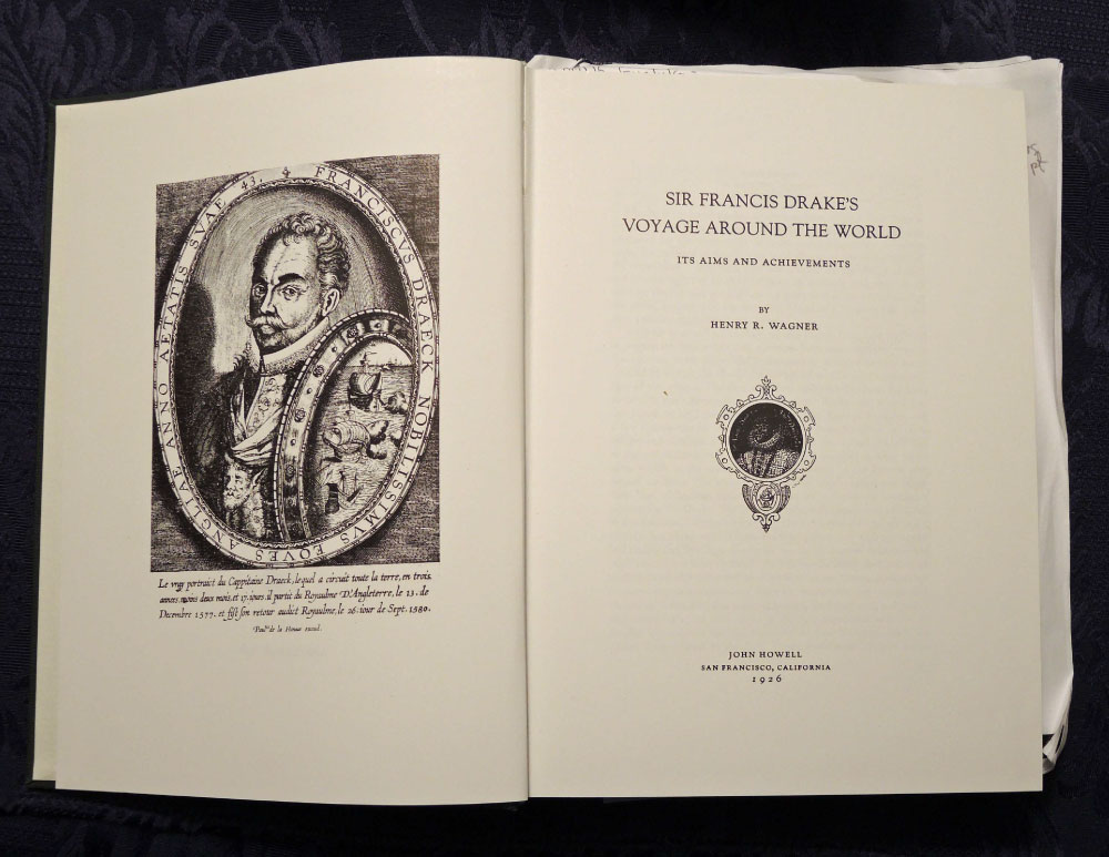
Wagner, Henry. 1926. Sir Francis Drake’s Voyage Around The World. Its Aims and Achievements, John Howell, San Francisco, California.
Willis, Helen. 1984. England’s Search for the Northern Passages in the Sixteenth and Early Seventeen Centuries. In: Unveiling the Artic (ed) Louis Rey, The Artic Institute of North America, pp. 453-472, The University of Alaska Press.