Originally Published in The Midden, 23(3), 6-7.
June 1991.
By Grant Keddie
Introduction
THE PICTURESQUE Gorge narrows near Victoria is a place where native Songhees dove deep into the water to gain special spirit powers. Here, at the beginning of time, Halys the transformer-being turned a young girl named Camossung into stone. Her name survives today as Camosun College and Camosun Street.
Just above the reversible falls caused by the shifting tides, members of the Victoria chapter of the Archaeological Society of B.C. dig into the oldest recorded shell midden on southern Vancouver Island.
Two years ago, a small area of the South Gorge Bridge shell midden /DcRu 5) was exposed during construction of a walkway underneath the Tillicum Road bridge. Below a thick shell layer, I observed a dark layer of midden with sparse shell, and I extracted a soil sample to date the charcoal it contained. To my surprise, the radiocarbon assay dates the layer to 4120 years ago!
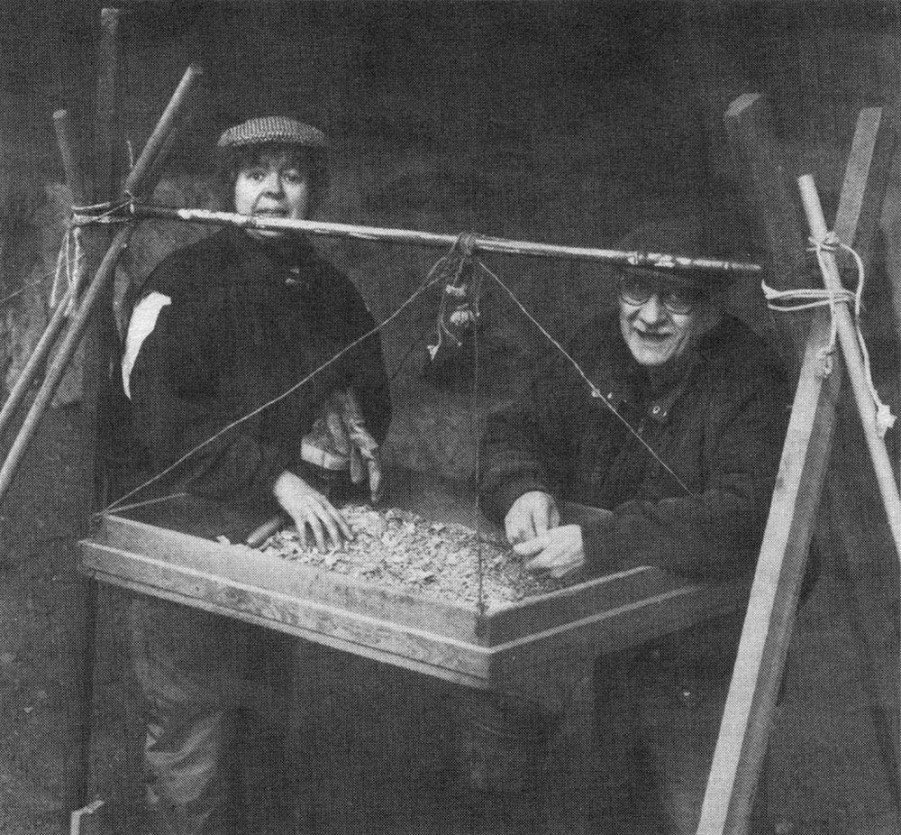
This April, the municipality of Esquimalt had planned to build another walkway through the cultural deposits. I obtained an impact assessment permit from the Archaeology Branch, and the ASBC- Victoria emergency response team under the leadership of Joseph Baur swung into action. We excavated one test pit with undisturbed cultural deposits and began several others where cultural deposits proved to be disturbed or nonexistent.
The upper, shell zone contained mainly native oyster shells (formerly numerous in the Gorge waterway). Next in quantity were bent-nose clams (found locally in small mud bays) and bay mussels (like those on the rocks a few steps from the site today). We found a few basalt flakes and very small quantities of bone. The diggers grew excited over every herring vertebra — while anglers fishing from the bridge above pulled up herring after herring, getting far more bones than we did!
Finally, we got into the lower, dark zone and Joe found the kind of artifact I was hoping to see — the famous “whatsit,” a small rectangular object made of steatite, with two holes in it. Since these objects of unknown function (perhaps personal ornaments?) are not present in components dating from the past 1700 years, the find confirms an early age for the top of the dark zone.
A similar dark soil layer containing fire-broken rocks, sparse shell, and bone occurs at the Fleming Beach site (DcRu 20) on Esquimalt’s southern shore. It sits several metres above the present shoreline and has a radiocarbon age estimate of 4151 years. The sample that yielded that date came from the deepest part of the Fleming Beach deposits (where an entire cross-section of the midden was exposed during house construction). At the South Gorge Bridge site, in contrast, we excavated another 60 cm of the lower zone without reaching bottom; the cultural deposits extend well below the dated layer and their base is probably 5000 (or more) years old.
Sea Level Changes
Why do the oldest sites along the present shoreline date to this period? Why are there so few of them? One answer may relate to sea-level changes. Between about 9250 and 5000 years ago sea levels in this region were lower than today. For the period between 5000 and 2300 years ago, we don’t know the location of the shoreline, though some suspect the sea was gradually rising, or fluctuating, during this time. The upper Gorge waterway was a fresh-water stream during the early occupation period of the South Gorge Bridge site, and this may account for the sparse amount of shell in the lower zone.
Interestingly, the oldest layers at three large, deep shoreline shell midden sites on the south end of Vancouver Island date to about 2800 years ago. The Willows Beach site (DcRt 10) in Oak Bay has a radiocarbon age of 2756 years, the Maplebank site (DcRu 12) in Esquimalt Harbour 2810 years, and the Goodridge Peninsula site (DcRv 48) in Sooke Basin 2814 years. Maybe, 2800 years ago is the time when the sea stabilized at near its present level. The evidence from the South Gorge Bridge site may be an important factor in determining when the shoreline reached its present elevation and thus provide crucial information for interpreting why prehistoric human settlements occur where and when they do.
Fortunately, the walkway was redesigned to avoid damage to the site. After a formal presentation and with support from the heritage advisory and parks committees, Esquimalt municipal council enthusiastically agreed to protect the remaining portion of the midden. It is now enclosed in a large cage that extends up to the underside of the bridge.

I dream of seeing the South Gorge Bridge site developed into a permanent outdoor exhibit with bright murals of native fishing activities instead of graffiti on the bridge wall, plasticized exposures of excavated midden faces, and attractive posters that explain the nature of the site. We will again see spirited diggers from the Archaeological Society uncovering the mysteries that this beautiful place offers to seekers of the power of knowledge.