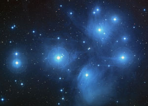
Nettle Fibre Beaters in the Collection of the Royal B.C. Museum

There are three wooden artifacts in the RBCM Ethnology Collection known as Nettle Fibre Beaters. Nettle beaters are much lighter than whale bone bark beaters that are designed for pounded larger cedar bark material. (See Keddie 2025; 2024; 2018 and 2016 for related material on Stinging Nettle). The nettle beater, RBCM2071, was purchased May 20, 1914 at Fort Rupert (Port Hardy) by Charles Newcombe. He noted: “Ft. Rupert 20/V/14. Yakuglas” – “Beating stick used in making nettle string found in house rubbish of old foundation”. This was mistakenly labeled on the Museum database as “bark beater”. Later additions to the RBCM database had: Paddle shape nettle beater with design. Kwakwaka’wakw Yellow cedar. Fort Rupert. Tsaxis. RBCN2071 nettle beater is an … Continue reading “Nettle Fibre Beaters in the Collection of the Royal B.C. Museum”

Stinging Nettle. Indigenous Processing and Use

Stinging Nettle, in various species of the genus Urtica, was an important resource for Indigenous people across the northern hemisphere of the planet. Its new shoots were eaten in the spring as a source of vitamins and minerals and the string made from its stalk was used to make everything from nets to the foundations for light clothing. See Skoglund et. al (2025) for overview of European usage. As stinging nettle needs partial shade and mineral rich soil that contains potassium and uric acid, it grows profusely on the cultural deposits built up at old village sites. The importance of nettle (Urtica dioica) in southern British Columbia is made clear in letters between James Douglas and the Hudson’s Bay company … Continue reading “Stinging Nettle. Indigenous Processing and Use”

Origin of the Signs of Lək̓ʷəŋən Project

The origin of many Indigenous related projects, such as the Signs of Lək̓ʷəŋən, get lost in time. This project began in 1993, as part of the plans to celebrate the 150th anniversary of the building of Fort Victoria and 125th anniversary of Victoria becoming the Capital of British Columbia. The Premiers Protocol Office invited individuals to established a celebrations committee from which a sub-committee was formed to celebrate Indigenous history. The sub-committee was made up of the late Chief Andy Thomas of the Esquimalt Nation, the late Chief Robert Sam, then a Councillor, and myself, then a curator of Archaeology at the Royal B.C. Museum. The celebrations sub-committee agreed that I would come up with a list of traditional place … Continue reading “Origin of the Signs of Lək̓ʷəŋən Project”

Camossung. Bridging two Worlds

Introduction The Gorge Waterway is a special place in the tradition and economy of the Indigenous Lək̓ʷəŋən people of Greater Victoria. The Gorge reversing falls were the focus a special creation story for the Lək̓ʷəŋən, but also became a special place of celebration for the European populations that infiltrated into their territory. It is a story of transition between interconnected worlds with a moral that is aimed at bringing about a better world. A theme of preservation that transgresses time. The legend of this beautiful spot produced the first name “Fort Camosun” used by both the Indigenous Lək̓ʷəŋən peoples and fur traders (see appendix 2). Today it provides the name of Camosun College and Camosun Street. In the Lək̓ʷəŋən tradition, … Continue reading “Camossung. Bridging two Worlds”

The Archaeology of the Gorge Waterway of Greater Victoria

Part 1. The changing Landscape and Victoria Harbour to Selkirk Waters. The Changing Landscape Twenty-one thousand years ago the Gorge Waterway, Victoria Harbour and all the beaches around Victoria were all deep underwater. This was caused by the glaciers pushing the land down as they approached the Victoria Region (Miskelly 2012; Clague 1983). The land rebounded to 14 meters above the present sea level by Thirteen thousand years ago (Keddie 2019). By 11.200 years ago the land continued to rebounded and the Gorge appeared for a short period of around 1,000 to 2000 years as an ocean inlet. As the land continued to rebound, the upper Gorge became dry land by 9200 years ago. The Gorge and Victoria Harbour became … Continue reading “The Archaeology of the Gorge Waterway of Greater Victoria”

A lək̓ʷəŋən Burial Island

Halket or Deadman’s Island (Please respect this special location and view it only from a distance). On southern Vancouver Island it was common for, at least some, Indigenous families to place their dead, on small Islands. In historic, or post contact times, burials were placed on these islands in boxes, canoes or small shed-like structures. It is unknown how far back in time this practice extends. Underground burials were common before 1000 years ago. One of these burial Islands, known to be used in the 19th century, was Halket Island in the Selkirk Waters above Victoria’s upper harbour. It is located north of the Point Ellice Bridge (Bay Street), between the foot bridge (old CN Railway trestle Bridge) on the … Continue reading “A lək̓ʷəŋən Burial Island”

Mystery of the Songhees Memorial Poles

Two older memorial poles, once on the New Songhees Reserve, have contradictory information about their provenience. Who carved them? One was originally owned by the Songhees Councilor William Roberts (1894-1938) and the other by the Chief Michael Cooper (1864-1936). The William Roberts Pole This pole is in the Royal B.C. Museum collection with two numbers. RBCM Ethnology # 5043 is the main pole, and RBCM #5051 is the eagle carving that was once on top of RBCM # 5043. It was purchased from Songhees Band member Alice James in 1940. The Report of the Provincial Museum of Natural History For the Year 1940 (1941:D14) refers to: ”By Purchase. Mrs. Alice James, Victoria. One totem-pole, 1 eagle figure”. Songhees Band member, … Continue reading “Mystery of the Songhees Memorial Poles”

The Capital Iron Site, DcRu-116. Victoria Harbour.

January 25, 2018. By Grant Keddie. The remains of an ancient village, in the form of a shell midden, are located around the intersection of Store and Chatham Street off Victoria’s upper harbour. The site, listed as DcRu-116,   was on a rocky bluff on the east side of the Harbour between the Johnson Street and Point Ellis (Bay Street) Bridges. This specific location on a rocky bluff with a good view up the Harbour would suggest the site was chosen for defensive purposes. Archaeological Excavations In 1976, buried shell midden was discovered during the removal of massive amounts of overburden for building a new facility next to the Capital Iron building at 1900 Store Street. On an emergency basis, volunteers … Continue reading “The Capital Iron Site, DcRu-116. Victoria Harbour.”

Honouring the Ancestors

The Great Songhees Potlatch of May 16-27, 1913. In 1911, the Songhees moved from their historic period reserve in the inner harbour (1844-1911) to a new reserve above Esquimalt Harbour where European style houses were built. At Maplebank, along the waterfront, five new buildings were constructed, commonly called Long Houses or Big Houses. These were a blend of both traditional and European style house construction, and used mostly for activities such as social gatherings and canoe building. Figure 1, shows the five new longhouses owned by: Left to right: Chief Michael Cooper; William Roberts; Jimmy Fraser; Jimmy Johnny; jointly owned by Alex Peter and Jack Dick. Chief Michael Cooper and representatives of Songhees families held a series of Potlatches over … Continue reading “Honouring the Ancestors”

The Shuttle-cock Lure. Fishing around the Salish Sea

By Grant Keddie The shuttle-cock lure and spear, was a unique form of technology used to catch mostly the larger lingcod and rockfish. The fisherman used this device at low tide from anchored canoes or rock points that overlooked kelp beds. The lure would be pushed down deep with a separate pole that was quickly pulled away from it. The lure then spun toward the surface, the fish darted after it and was speared when it came near the surface. The spear was 4.5 to 6 meters long. It consisted of two or three, unbarbed, fir shafts on the end. The shafts were about 4cm thick, 46cm long and about 10 cm apart at their tips (Swan 1870; Jennes 1934-35; … Continue reading “The Shuttle-cock Lure. Fishing around the Salish Sea”